LaSER SCANNING

Aerial LiDAR uses laser pulses
from a drone paired with
high-precision GNSS
to capture extremely accurate ground and structure data. The result is detailed 3D terrain and site data
delivered quickly and safely
for design and planning.
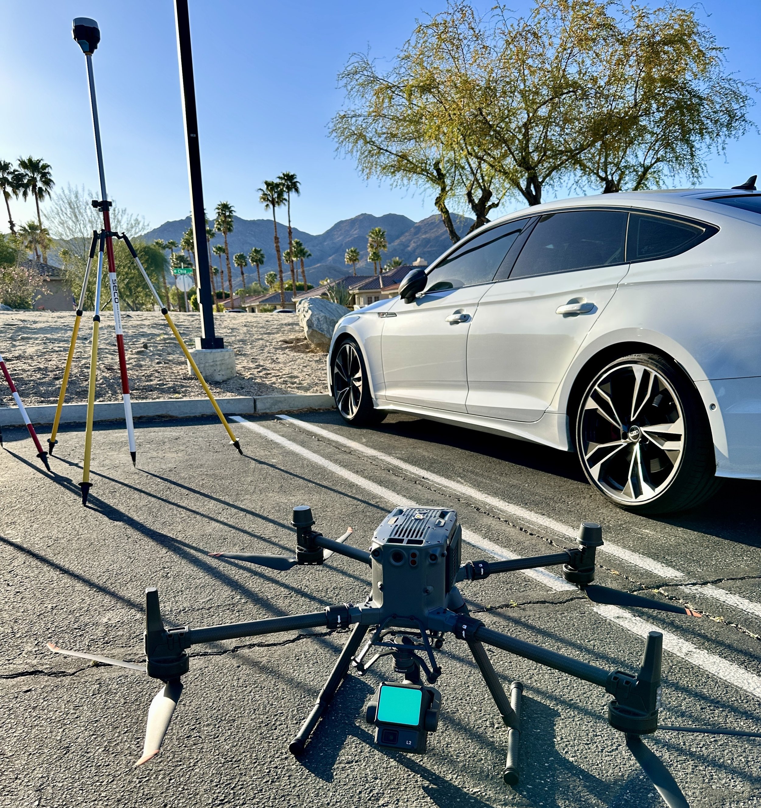
DJI M350RTK + Zenmuse L2
Terrestrial LiDAR uses ground-based laser scanners to capture highly detailed measurements of
buildings, interiors, and site features. It produces dense, accurate 3D data ideal for existing-conditions documentation, design, and
renovation planning.
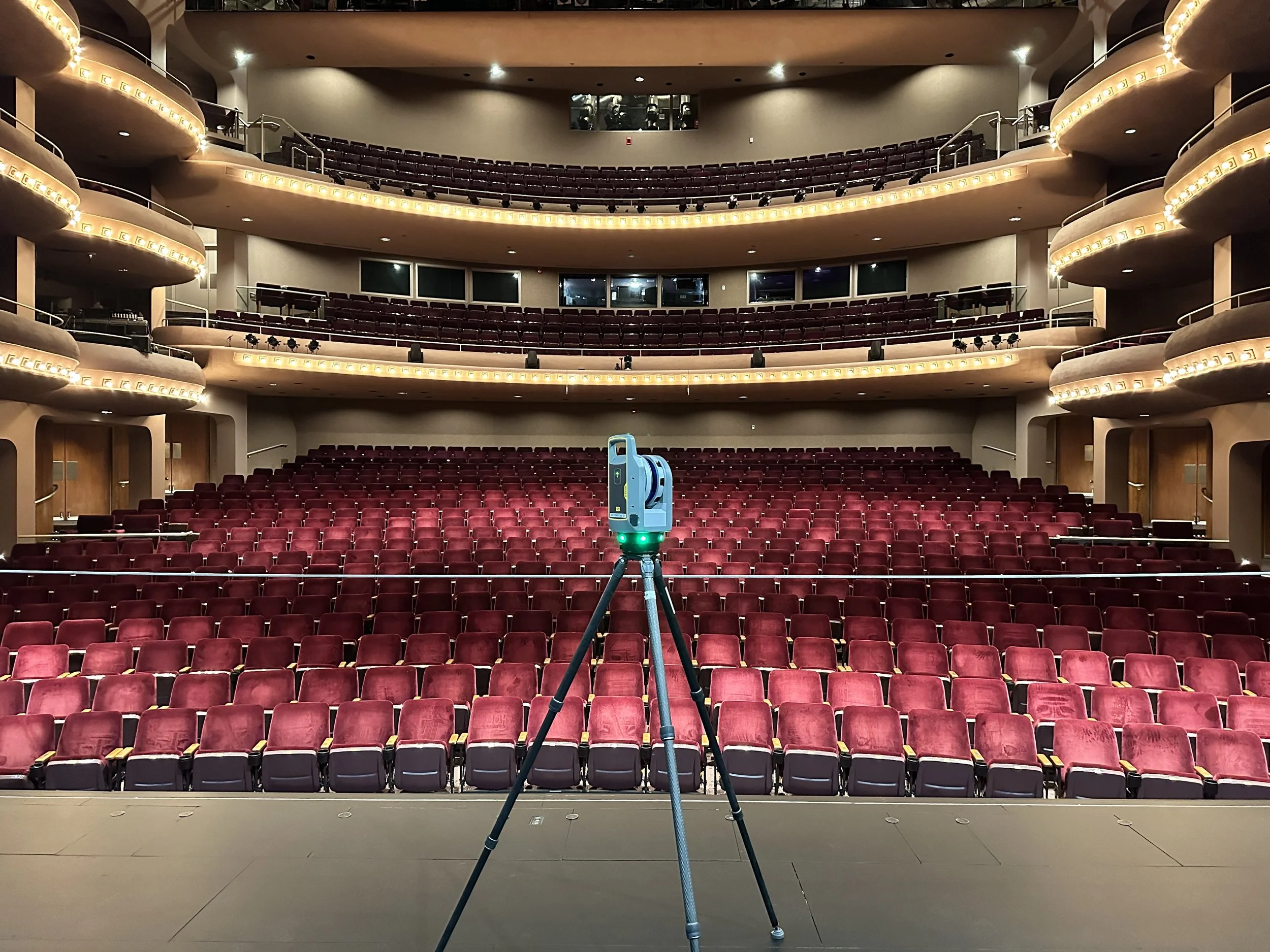
Trimble X9 (150m Range)
3d CAD
We use accurate point cloud data to create clean, reliable 3D models optimized for SketchUp, Revit, Vectorworks, Rhino, 3ds Max, and Blender.
Need a different platform? Just ask.